Tuesday, December 31, 2013

Montgomery St at Jersey Ave

before
after

As I have had an addition to the family, it's been a while since the last posting - caring for a newborn takes a surprising amount of time... but I am digressing.

Similar to this previous post, the pictures show another example of where the City of Jersey City acquired several buildings and replaced and/or converted them to affordable housing. The three buildings to the left in the picture, with a total of 5 bay windows, are still standing but without the original details, while the three to the right were demolished and replaced with new structures. Presumably in order to make the floor levels even to allow for apartments and internal hallways to span across the different structures.

The photos below show the buildings behind the trolley in the old photo before they were demolished in the early 1980s.


The building that can only be hinted at the far right side of the then / now pictures is one of the older buildings in this section of downtown - it stand on the corner of Jersey Ave and Montgomery St, is known as the Jewell House and is a former Governor's mansion. The Public Library has an early photo showing the mansion before any of the surrounding buildings were constructed. In that image the building is surrounded by fields, vegetable lots and green houses. The amazing image has been published on on page 61 in this book : Images of America, Jersey City by Patrick Shalhoub.


Picture Credits :

The then and now photos are from my private collection. The three black and white photos immediately above are from library of congress, here, here and here.

Location :


View Larger Map

Thursday, October 31, 2013

Lembeck & Betz Brewery - 9th Street at Marin Boulevard / Henderson

before
after


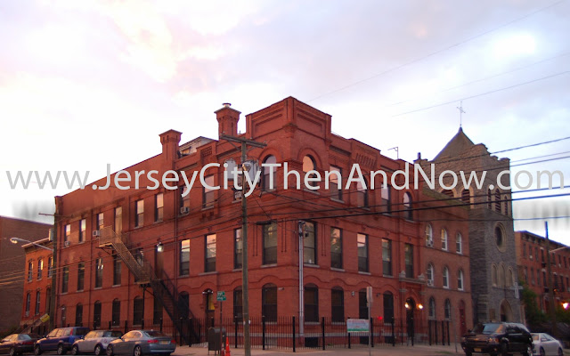
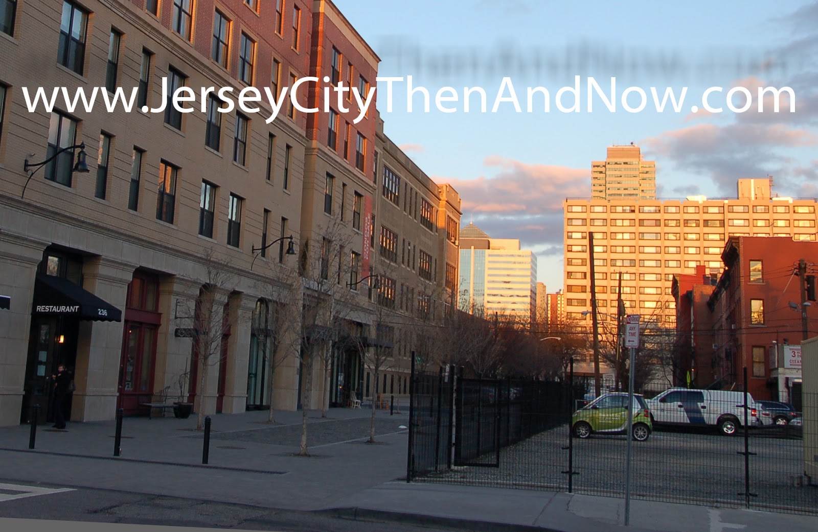
Did you know that there was a brewery that covered a whole city block just around the corner from Hamilton Park in downtown Jersey City? I did not...

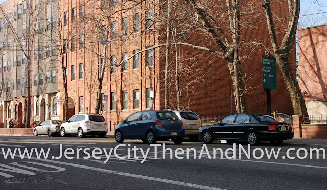
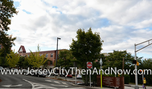
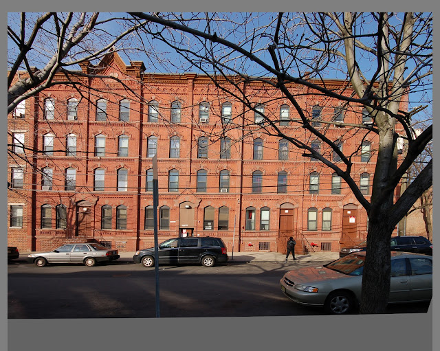
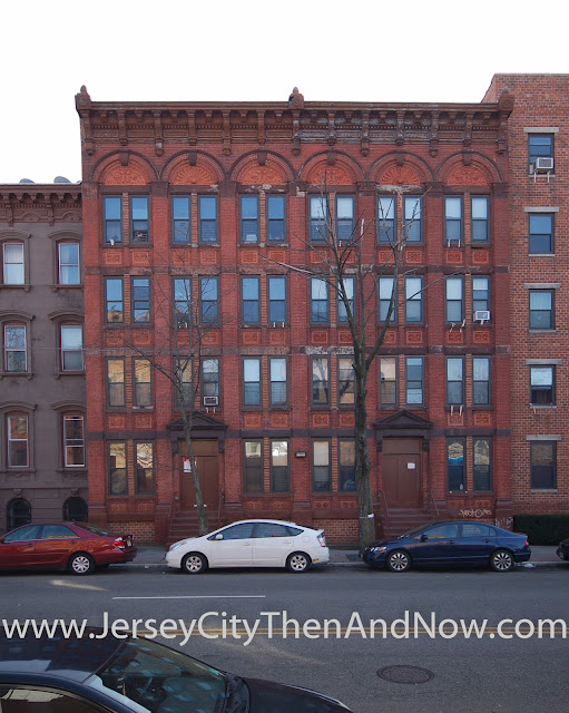
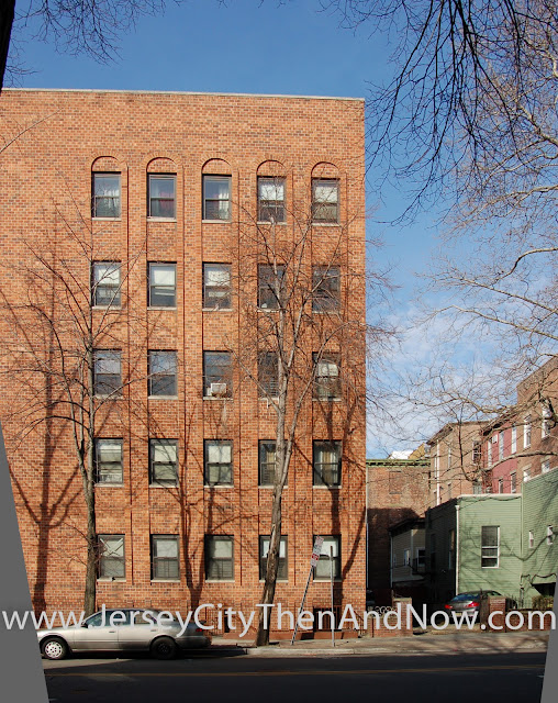
The pictures above are taken from the intersection of Marin Blvd (aka Hendersen St) and 9th Street looking north-west  - the main facade of the building is facing 9th Street.

The brewery was the Lembeck & Betz Brewery and the complex was built in phases, from 1869 onwards, took up more than one city block, dried up during the prohibition but stood for more than 100 years, was put on the National Register of Historic places and was then demolished by the City of Jersey City in 1997.

The sketch below shows the brewery around 1870:


After rapid expansion the complex looked like this in 1883:


The City of Jersey City owned the building (after the previous owner defaulted on taxes) when it was put on the National Register of Historic Places 1980s - a few years after Van Vorst and Hamilton Park areas were added to the register.


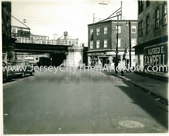
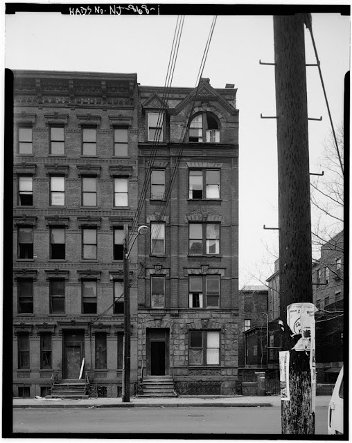
The image below is from the application for the national register. In the distance one can see the storage buildings / warehouses (I believe owned by Swift Co./Sioux Pork) what used to stand where the Newport Mall parking garage is now located.


Only places of national importance are added to the National Register of Historic Places. Being on the register should in theory provide some protection from inappropriate changes and even demolition. But while Jersey City owned the buildings they were not protected in any meaningful way. In the 1990s, the City of Jersey City, engaged a local architect on a consulting retainer and bought a report that declared that the buildings were structurally unsound.

Even though I did not have the chance to visit the complex before it was demolished I find it hard to believe that all the buildings that made up the complex were so deteriorated that there was no other option than to demolish all of them : the complex was developed over several decades and individual buildings were added and extended at various points. That somehow every single building that made up the complex had become so structurally unsound, between the time that they were added to the National Register in 1984 and 1994, that there was no way to save any of them seems improbable.

But the consultant's report provided the City of Jersey City with the evidence it sought to, in 1994, convince the 'New Jersey Historic Sites Council' to support a request from Jersey City to allow the demolition of the historic site - and so was done in 1997.


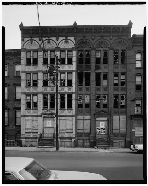
This is what the Lembeck & Betz complex looked like in 1997, right before demolition.


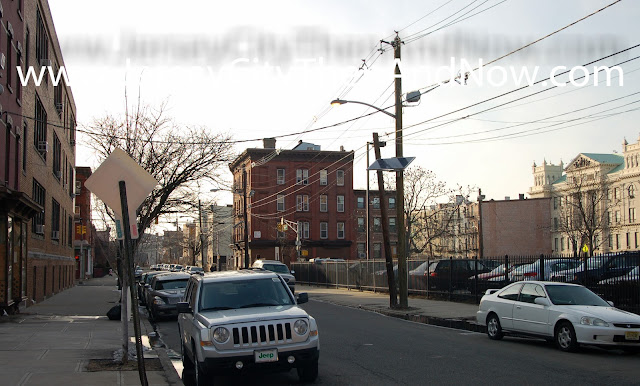
After demolition the historic brewery was was replaced by an uninspiring three story structure.


I am sorry for the negative tone in this post - but I think that the destruction of the historic brewery is such a wasted opportunity. I can understand that vacant buildings were demolished in the 60s through 80s when people were leaving Jersey City in droves - Jersey City was at that time a very different place compared to today. But in the late 90s the rebirth of downtown Jersey City was already under way.

To completely demolish a historic complex of national significance and then shortly thereafter replace it with a bland building with a similar foot print is incredibly short sighted. Instead of tearing down and building new, could not some of the buildings that amounted to the required square footage have been kept and rehabilitated to regain some of the historic character? The demolition was not even done by a profit motivated developer. It was done by the elected officials / administrators at the City of Jersey City itself - that ostensibly are meant put the city's best long term interest first.

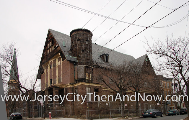
I just hope that we learn from mistakes and that the Jersey City Power House (that has also been put on the National Register of Historic Places and is currently vacant) does not face a similar destiny and instead that it's potential as a focal point for the community is realized.


Epilogue to Lembeck and Betz


When we were redoing our backyard brick patio, my neighbor, a lifelong Jersey City resident, told me that the previous owner of the house had got the patio bricks from the demolition rubble of the Lembeck & Betz brewery site. Apparently many other residents in the Hamilton Park area also picked up bricks from the site : there are patios, brick fire pits and the likes across the neighborhood made from reclaimed bricks from the brewery.


The photo below shows what some of the remains of the Lembeck and Betz Brewery looked like in October 2013:


Credits and More Information

Photos from the original submission for National Registry of Historic Places, including the sketch from 1870 above:
http://pdfhost.focus.nps.gov/docs/NRHP/Photos/84002707.pdf

Map at Boston Public Library that includes the sketch from 1883 above:
http://maps.bpl.org/zoomify?baseUrl=http://maps.bpl.org/&viewer=modern&id=06_01_003052

Library of Congress has several photos from right before the demolition in 1997:
http://www.loc.gov/pictures/item/nj1618/

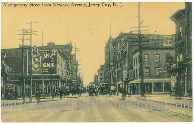
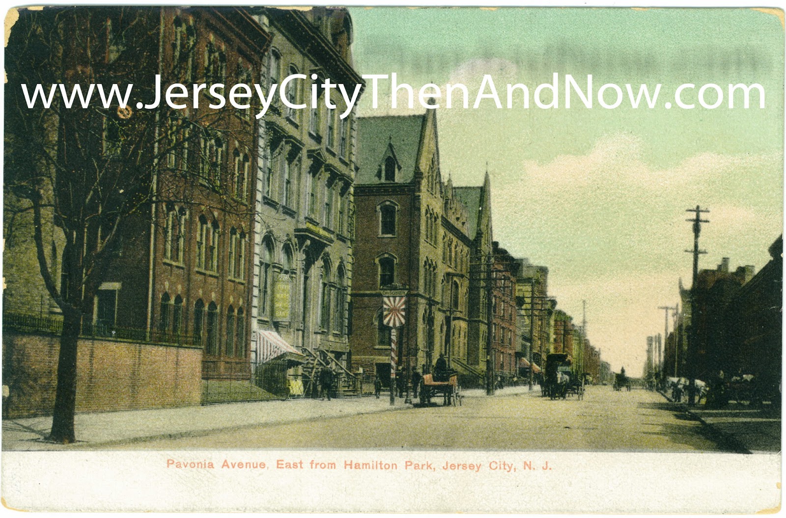
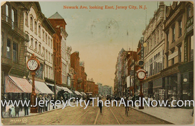
The old picture from the slider is from the book "Jersey City of Today - its History, People, Trades, Commerce and Industries" that was published in 1909 and available on Smithsonian Libraries.
http://library.si.edu/digital-library/book/jerseycityoftoda00muir

New Jersey City University Entry
http://www.njcu.edu/programs/jchistory/pages/l_pages/lembeck.html

Wikipedia Entry
http://en.wikipedia.org/wiki/The_Lembeck_and_Betz_Eagle_Brewing_Company


View Larger Map

Tuesday, October 22, 2013

Montgomery St at Warren St and Newark Ave

before
after


The photos in this post are taken from Montgomery Street looking east, towards the Hudson.

At the time when the old photo was taken, Montgomery intersected not only with Warren St but also with Newark Avenue. The ‘askew’ intersection of Newark and Montgomery can just barely been seen in the outline of the side walk at the left side of the postcard.

As mentioned in previous posts, a several block large area was razed in the 1950s to make way for what eventually became the Metropolis Towers. Newark was at the same time shortened to end at Railroad Avenue (now Columbus). It is likely that the widening of this part of Montgomery Street (that can be seen in images above) happened at the same time.

When looking at old maps, e.g. this from 1804, one can see how Newark Avenue previously had continued not only to Montgomery as in this postcard, but to York St. And even earlier, before Jersey City had become a town and it was ‘just’ a fort in what is now the Paulus Hook neighborhood, what became Newark Avenue was the one and only track that lead down from the palisades / heights, cutting through marshlands on both sides, to the fortification in Paulus Hook (Powles Hook) insert link to LOC.

Of the buildings in the old postcard, it’s only the buildings on the right hand of the street, beyond the intersection with Warren that are still standing today. One of them, Montak House (the name is painted on the side of the building in the old postcard, above an offer of single beds at 15 cents per night), has recently undergone extensive renovations to restore the façade. Kudos to the developers and/or historic preservation commission for safeguarding the façade of the building.

In a future post, I’ll upload a photo from the 1950s that shows Newark Avenue from Railroad Ave / Columbus Way leading to Montgomery Street, in which one can see these buildings (e.g. Montak House) in the distance. Stay tuned…

Always appreciate feedback and interaction – please use the comments functionality below and drop me a line if you have photos to share. And make sure to like the blog on Facebook / Google+ so that others that may be interested find out about this page!

Credits

The old postcard is from my personal collection.


View Larger Map

Wednesday, September 11, 2013

McCloskey's Drug Store - 351 Montgomery St at Monmouth St

before
after


The photo and post card shows Montgomery Street running east towards the Hudson, at the intersection with Monmouth Street.

Even though many of the buildings in the old postcard are covered by greenery in the new photo, the images are from exactly the same location - when using the slider one can see how the windows on the first building on the right lines up between the old and new pictures. And so does the roof line of the building just beyond the building that housed McCloskey's Drug Store.


When the old post card photo was taken Montgomery St was a cobble stone street. The advertising on the pharmacy reads "Canada Pine cures coughs". The sign on the commercial space on the building on this side of Monmouth St reads "Laundry" (between the Canada Pine sign and the blue car).

The building that housed McCloskey's Drug Store on the far corner was torn down in the early 1980s to make way for public housing as part of the Montgomery Gateway project. Before the buildings were torn down, they were documented and these documents have made their way to Library of Congress, where these photos are from.

The building with the awning with "La Esquina Famosa" is the one that used to house the pharmacy. The first photo shows the facade facing Montgomery St:


The second photo shows the side of the building facing Monmouth Street:


The photo below depicts the terrace of buildings on the right in the post card. In the post card only two columns of windows can be seen; those are the two columns to the left in the photo below. Even though they were in pretty poor condition, the buildings were saved and turned into public housing.


There were many buildings along Montgomery Street that were torn down in the 70s/80s. The building that housed McCloskey's Pharmacy in the old post card seem to be in rather good condition in the photo above from 1979 - a shame it was demolished after 100 years.

Credits

The old postcard is from my personal collection. The black and white photos are from Library of Congress, here, here and here.


View Larger Map

Thursday, August 29, 2013

Newark Ave at Grove St (Grove News Corner)

This is a different post compared to the 'normal' then-and-now posts, but someone noticed that the vinyl siding is was being removed today from the first building on the left in post card - currently housing Grove Corner News. Does anyone know what the plans are for the building?

A restoration to it's former glory with those amazingly curved windows on the second floor would be a real lift for the Grove Street plaza. And what a place for a bar or cafe.

But that might be too good to be true?


Tuesday, August 27, 2013

Newark Ave at Railroad Ave (Columbus Ave) (Grove Pointe)

before
after


Back to normal form with this post : not a single building from the old photo stands today... 

The photos are taken standing on Newark Avenue, at the intersection with Railroad Ave (now called Columbus Ave), looking towards the Hudson River along Railroad / Columbus Ave.

As mentioned in another post, Railroad Avenue got its name from the railroad that ran along it and can be seen to the right in the old photo. When first built, the railroad ran at street level, but later it was elevated as seen in this photo.

Based on the caption in the old photo, it was probably taken Dec 17th, 1909.

It seems as if they are putting down sewer pipes in the old photo - given the age of Jersey City sewers, I would not be very surprised if the pipe that can be seen laying on the ground is still used in the sewer system today...

Also take note of the tracks in the lower right corner of the picture that run on Newark Ave - there used to be a trolley running to the Pennsylvania Railroad Terminal at what is now Exchange Place.

While Newark currently ends at Columbus Avenue, it used to continue a few more blocks, through what is now the site for Metropolis Towers, all the way to Montgomery St.

As also mentioned in a previous post, all seven (7) city blocks between Columbus Ave to the north, Montgomery St to the south, Marin Blvd (formerly Henderson St) to the west and Warren St to the east were demolished in the 1950s, to give way to empty lots and what eventually became Metropolis Towers.


I think that one or two of the buildings in the old photo (probably 90 and 92 Newark Ave) were standing until they were demolished in the mid 2000s to clear the site for Grove Pointe. At that point they had lost their architectural details though, and were hardly recognizable.

There has been a debate in various forums of whether the Grove Pointe building has had a positive impact on the development of downtown Jersey City, or whether it just rode a wave of development that had already started. I don't claim to know, but while it's unfortunate that some historic buildings were demolished, one could at least hope that a significant influx of residents (there are 525 units in Grove Pointe) would mean more people would frequent local restaurants and shops.


What do you think? Do you have information or anecdotes? Please use the comments functionality below.


Credits

The old picture is from Jersey City Free Public Library's great collection of historic pictures in the New Jersey Room at the main branch.

The map is from Rutger's online collections.


View Larger Map

Friday, August 9, 2013

Knights of Columbus - Bright St at Jersey Ave

before
after


A post is long overdue, so here we go...

 As a change compared to the most recent posts, most buildings in the old image are still standing today. The old post card refers to the building as the Knights of Columbus Hall and that may have been its usage when the post card was printed. However, the building was in all likelihood built for the 'Palma Athletic Club' in the 1870s or 1880s. A sketch of the building is included in the 'American Amateur Athletics and Aquatics' compiled by Frederick William Janssen in 1888 (page 137). The book can be found on books.google.com. It contains the following description of the building (and more):

[The Palma Athletic Club has ] a splendid club house at the corner of Jersey Avenue and Bright street. As you enter the building you go directly into a splendid bowling alley which with a rifle range, entirely occupies the ground floor.
[...]
Directly over the bowling alley and rifle range are the parlors and reception rooms. Rising to the full height of the building in the rear and occupying a space 40 by 48 feet is the gymnasium. The club is social as well as muscular, ladies who are friends of the members being given the privileges of the bowling alleys and rifle range five afternoons each week.

Apart from the cars, the main difference between then and now are that the architectural details and turret on the upper level of the building in the center of the images have been removed. They really added to the character of the building and that it's unfortunate that they have been removed. On the other hand, it would not be particularly complex to re-create them...

I wonder if there are any traces of the bowling alley or rifle range in the building today...

Again - it would be fun to hear from you and if you have information or anecdotes, please use the comments functionality below.


View Larger Map


Monday, June 24, 2013

Henderson St (aka Marin Blvd) and Newark Ave

before
after


I think the difference between the old and new photos shown from this location is pretty fascinating.

The photos were taken from Marin Blvd (previously known as Henderson St) looking north towards Columbus Avenue (previously known as Railroad Avenue).

When I first moved to Jersey City I wondered why Columbus Avenue was so wide compared to other streets in the downtown area. It was only later that I found out that there used to be a railroad running along it. The street used to be called Railroad Avenue, and it got it's name from the elevated railroad that ran along it to the Pennsylvania Railroad Terminal at Exchange Place.

Between Brunswick and Henderson the elevation was an iron trestle, but east and west of this there was an embankment with stone siding. This embankment is still (2013) standing west of Brunswick and the old photo shows the connection between the trestle and the embankment from Henderson running east to the waterfront.

There are two buildings from the old picture that are still standing today : The A & P Warehouse behind the trestle to the left and another warehouse behind the iron trestle that has been converted to loft apartments. The latter still has an old water cistern on the roof but the building has been painted uniformly light beige.

It's not well known amongst Jersey City's residents today, but Newark Avenue used to continue all the way east to Montgomery St, through the current location of the Metropolis Towers. In the old picture it's Newark Avenue that continues between the buildings to the right in the picture. In the fifties several blocks of old buildings (including the ones to the right in this photo) were demolished to make way to these new high rises.

When looking closely at the old picture, you can see the eastern entrance to the Grove Street Path station under the iron trestle.

In the map below, the old street grid can be seen, before the demolitions in the fifties. The old photo was taken between the blocks with number 170 and 203 written on them in the map.


Do you happen to have photos from the streets that were eliminated (Newark Ave, Gregory St and Coopers Place) in the fifties? Please send me an email, and with your permission I'd like to share them on this blog.

Credits: Both photos are from my personal collection. The map is from Rutgers collections here.


View Larger Map

Tuesday, May 28, 2013

York Street / Henderson Street (Marin Blvd)

before
after


This street has changed quite a bit... actually this whole area of downtown Jersey City has been dramatically altered.

The area between
  • Henderson St (now called Marin Blvd) to the west and 
  • Greene St to the east, and 
  • Railroad Ave (now called Columbus Ave) to the north and 
  • York St to the south 
was razed in the 1950s to give way to high rise buildings. One project took a particularly heavy toll - the Metropolitan Towers.
From the late 1800s to the 1950s, this section of Jersey City was dominated by three to five story commercial brick buildings - the kind that are still standing on Newark Ave, between Grove and Jersey Ave. Many of the buildings were very ornate, as I will show in future posts.

But during the 40s and 50s downtown Jersey City had declined. It was because Jersey City was a railway hub, and the importance of railway had been giving way to cars and trucks. The housing stock reflected this downward slide with many boarded up and vacant buildings.

But what happened when planning for the high rise project that eventually became Metropolitan Towers seems excessive even against this backdrop - several blocks of downtown Jersey City was razed and two large sections of two streets were eliminated from the map.

Today Newark Avenue ends at Marin Boulevard, but it used to continue to meet Montgomery Street. There was also a street parallel to Newark Ave called Gregory Street. All of the buildings on all of the blocks facing these streets were demolished and the streets themselves literally vanished from the maps (and the real world).

The map below shows the streets and blocks before the demolition frenzy in the 1950s.


Going back to the photos : the photo is taken on York St looking west towards Marin Blvd (aka Henderson St.). The building on the right in the old picture was one of the buildings that was erased to make way for Metropolitan Towers  - it was the American Railway Express Co. stables.

Beyond the intersection with Henderson is the building that put me on the right track to locate where the old photo was taken - the corner building that currently houses a bodega. It was the bricked up windows on the second and third floor that provided the crucial clues - there are not many of those bricked up windows in downtown Jersey City.

I believe there are some aerial shots of the section of downtown available online from during the demolition work that made way for Metropolitan Towers - if you know where to find such photos, or have anything else to share, please post a link in the comments.


View Larger Map


Photo Credits
The map is from Rutgers, and the photos are from my collection.

Sunday, May 19, 2013

Hamilton Park / Pavonia Avenue

before
after


It took me a long time to understand exactly where this postcard photo was taken, despite the details of the location on the postcard. Today the location looks nothing like it did a hundred years ago - none of the buildings that are clearly visible to the left in the old post card are standing today. But the recent photo is taken in exactly the same location.

The first building on the left in the old postcard, behind the brick wall, is the chapel at St Francis Hospital. That whole structure can be seen in this older post. It was the postcard in the older post (that I got more recently) that confirmed the exact location of this picture.

The next building, the building on the corner of Erie St (202 Pavonia Ave at Erie St) with the sign outside was a bank - Fifth Ward Savings Bank.

The sign on the sidewalk looks very much like an advertising sign for Dortmunder Beer that I have seen in some other old post cards from Jersey City. But I am not sure if that is what this sign is advertising - the text is just too small to read.

The large building on the next block facing pavonia was St Micheals Home. I plan to feature that in a future posting

Note that Pavonia Avenue used to be wider than it is today. But I also believe that recently, before the construction of the current buildings, Pavonia Avenue was blocked by a hospital building at Erie, and did not reach the park.

I would like to hear from you! To post comments, you may have to click a 'No Comments' hyperlink below(not 100% intuitive, I know).


View Larger Map

Monday, May 13, 2013

City Hall / 2013 Jersey City Elections


Jersey City's mayoral and city council elections are on Tuesday May 14th. This is the most important local election in a long time and it will determine the future direction of our city and community.

So, if you have not done so already, take a few moments now and go to google/bing, search for Jersey City Mayoral Election or go to a local news papers (e.g. nj.com) and do some research on the candidates : what they stand for, what they have been up to in the past 4 years and what they hope to achieve for the city in the next 4.

And then do your civic duty & privilege and cast a vote for your candidate on Tuesday.

Have your say in the future of our city!

Friday, May 3, 2013

Hamilton Park - St Francis Hospital / Hamilton Square

before
after


A lot has changed at Hamilton Park during the last one hundred years, including in the last few years.
At the turn of the last century a beautiful hospital building that housed St. Francis hospital was standing at the Park.

I don’t know exactly when, but I believe it was demolished some time in the sixties or seventies based on old photos. It was replaces by a bunker-like structure. There are some interesting pictures here of what the bunker-like buildings used to look like right before they were demolished in 2006 / 2007 to give way to the latest developments.

In my opinion the current buildings are a vast improvement over what used to be there, and that they are residential, with the increased population density, means that the park is more lively too and more facilities (e.g. stores, restaurants) can be sustained in the local area - such as Mdm Claude's Wine Shop.

In the historic photo Pavonia avenue extends for at least several blocks towards the water. Now the street is blocked by a tall building and beyond that the Newport Mall blocks the path to the water. The second building on the left beyond the chapel was a bank building and on the next block St Michaels’s orphanage used to reside. I will post close-up pictures of these in the future...

Take a closer look at the building in the far left corner of both images - it seems to be the same old building standing, though it's currently covered in asphalt siding.

The google map street view below is not from exactly the same positions, as the construction was going on when Google took the pictures and access to the street was blocked.


View Larger Map

Monday, April 8, 2013

North Baptist Church - Jersey Ave and Fourth St

before
after


It's about time to post something new, but am in a bit of a rush, so will take something of the shelf.

I had walked by this church several times and seen old postcards of it, before putting two and two together, and realizing they were the same. When seeing the church from the street, I had not realized that is used to be more 'cube-like'.

The church was badly damaged in a fire 1978 and lost it's secondary facade (of the transept, I believe). More can be read here.

It seems as if the old post card was taken from on-top of the old funeral home across the street, that is currently (April 2013) stalled in renovation. I took the new photo from street level - so they don't line up very well.

(Note that the fire hydrant in front of the church is still in exactly the same place as a hundred years ago.)


View Larger Map


Wednesday, March 27, 2013

Jersey City Athletic Club - Clinton Ave at Crescent Ave

before
after


In this post we are departing from downtown Jersey City and into Bergen-Lafayette, for a change.

I first saw a drawing of Jersey City Athletic Club in a turn-of the century article (about 1900) about new athletic clubs in the New York area online. Unfortunately I can not remember where I found it - I believe it was a New Jersey state archive or similar. This had the approximate address of the club. Using this, in combination with the old Plat maps from Rutgers, is how I managed to locate the building.

I also saw a drawing of Jersey City Athletic Club by local artist August Will (1834-1910) at the Jersey City Museum. The drawing is available in their online catalog here.

This is an article from 1889, celebrating the clubs 10th anniversary!

When I took the photo I met a long-term neighbor that mentioned that the building had bowling alleys inside and that it had been used as a masons lodge in the 50s that spared no expense on lavish meals.

Given the current condition, I wonder how long it will survive? A shame on such a beautiful building.


View Larger Map

Sunday, March 17, 2013

168 to 174 Mercer St at Monmouth St

before
after


This building on 168 to 174 Mercer Street in downtown Jersey City is another photo example, in addition to this and this, that shows burnt out and boarded up buildings that were obtained by the city of Jersey City - some were torn down and replaced while others were saved.

The ones pictured above were amongst the lucky ones...


Picture Credits
The old pictures comes from Library of Congress' extensive catalog of historic documents.


View Larger Map

Thursday, March 14, 2013

329 - 331 Montgomery St at Jersey Ave

before
after


This is another photo of buildings on Montgomery Street in Jersey City from 1979. Jersey City had gone through some tough decades and the buildings were obviously pretty beat up at that point.

Similar to the buildings featured in this post, a couple of buildings were torn down (in this case the ones to the right featured in the photo) and replaced with new ones. The new buildings and the ones left standing were combined into public housing ; the interior of the buildings were combined and one floor runs all the way through all of the buildings - new and old.


View Larger Map

Tuesday, March 12, 2013

298 Montgomery St at Jersey Ave

before
after

In the next couple of blog posts I will focus on Montgomery St and use photos from Library of Congress' collection. Most of the photos are from 1979, at a time when Jersey City was a bit down on its luck.

The buildings that can be seen to the right in the photos are the back of the buildings facing Jersey Avenue. The back of the buildings are configured almost exactly the same today, as they were in 1979 - no new extensions have been built. The only differences that I can spot is that one window has been bricked up, and some lighter colors have been used on the wood work.

It's a completely different story with the buildings to the left, 298 and 300 (?) Montgomery St. Even though the exteriors seem to have been in decent shape in 1979, the ground floor of the building to the left is boarded up.

At that point there seem to have been quite a few abandoned buildings on and around Montgomery St that were obtained by the city of Jersey City. As I will show in upcoming posts several of the buildings were in much, much worse conditions than those that can be seen here.

Some of these buildings were tore down and replaced with public housing. In the example of 298 and 300 (?) Montgomery St above a couple of buildings were torn down and replaced with new buildings and combined with rehabilitated buildings next to them (to the left  of what can be seen in this photo, I'll show it in an upcoming post).

Even though Jersey City went through some hard times in the 70s and 80s, its unfortunate that many beautiful buildings became casualties of these struggles.

TBC.

Picture Credits
The old pictures comes from Library of Congress' extensive catalog of historic documents.


View Larger Map

Wednesday, February 27, 2013

Newark Ave between Erie St and Grove St

before
after


The north side of Newark Ave, between Erie and Grove Street has retained a lot of turn-of the century buildings and their architectural details have been restored. The south side is a different story though... Several buildings have been torn down and replaced with one story retail spaces.

However, if looking closely at the three buildings that are nearest to the photographer on the right hand side in the photos above, it is probably the 19th century buildings that are still standing. These three buildings have exactly the same total (as well as floor height) as the buildings in the old postcard, and it likely that they just had their original facades covered up in the 70s or 80s.

Also, if you visit what is currently the 'C H Martin' store (third building on right-hand-side) you will notice that the ceiling is a tin ceiling on the ground floor - suggesting the building would be significantly older than the facade would have one believe.

Imagine if the facades of these buildings were restored to their former glory - that would be an important step towards revitalizing this whole section of Newark Ave.

(A funny detail is the clock to the left in the old photo - in that photo the base is in itself as tall as a grown man. The clock that is in the same place today is significantly lower.)

Picture Credits

The old picture is from Jersey City Free Public Library's great collection of historic pictures in the New Jersey Room at the main branch.

Using the Picture Slider

You should be able to use the green handle in the middle of the picture above to show more or less of the old and new pictures.

  • In recent versions of Firefox and Internet Explorer you should be able to click on the green handle in the picture and (while still holding down the mouse key) drag it from left to right to show more or less of the old picture.
  • In other browsers you may need to single or double click on the image, to make the slider move to the location where you clicked.


View Larger Map